ホーム » Objective-C
「Objective-C」カテゴリーアーカイブ

SwiftでOpenCVを使用するためにOpenCVのFrameworkをbuild
OepnCVをSwiftから使用するにはObjective-cのラッパーを作成する必要があり2度手間で面倒くさい。
以下のサイトにSwiftから直接呼ぶ方法が記載されていたので確認しながら試してみる。
OpenCV が Objective-C / Swift で使えるようになります & 使ってみた
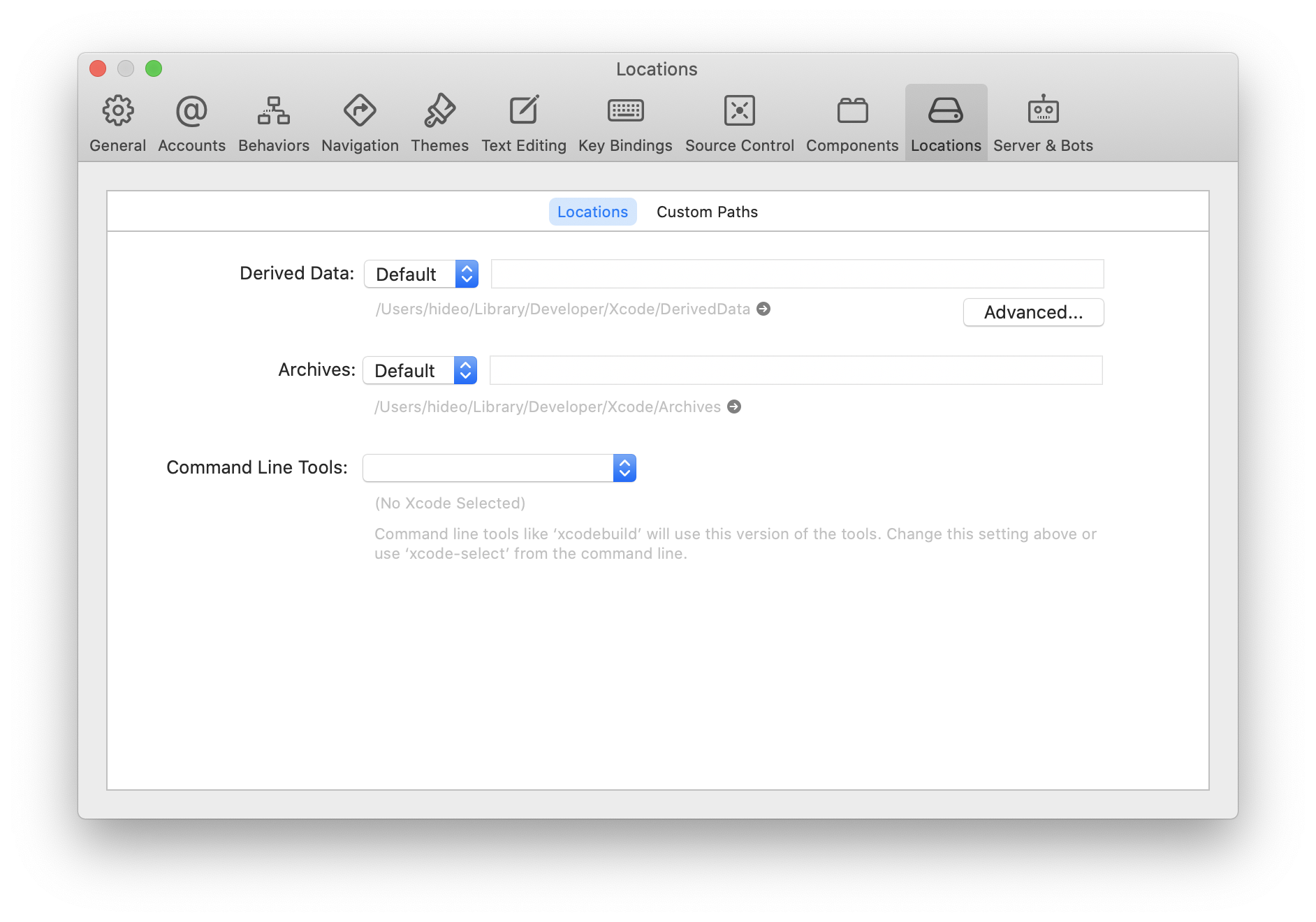
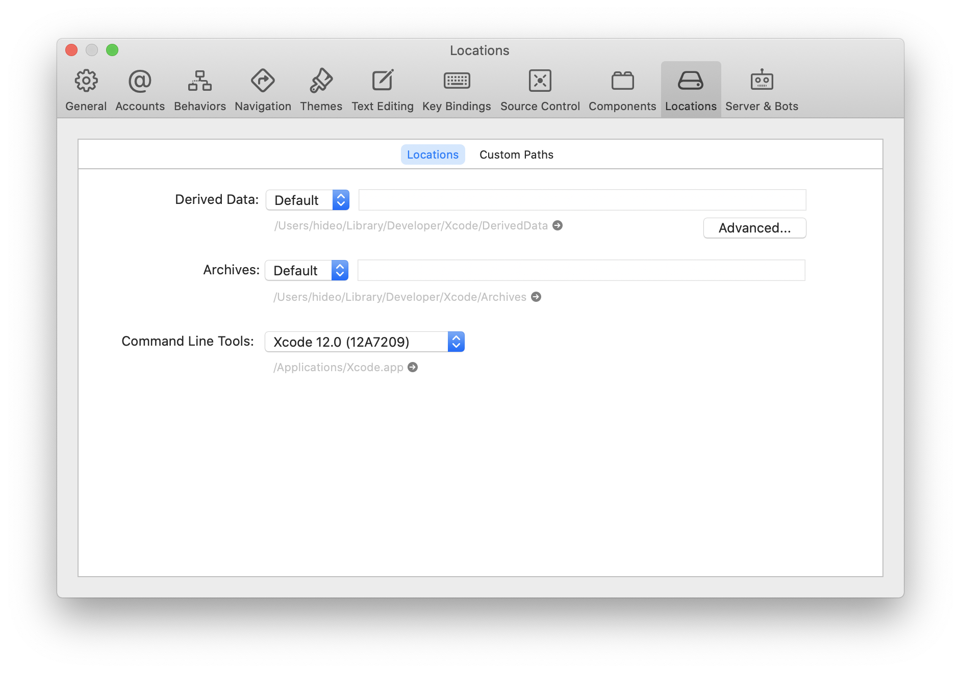
Xcodeを起動して「preferences」の画面を開きCommand Line Toolsが未選択ならば選択する。
未設定
設定済み
Swift、Python、cmake、Xcodeのtoolのバージョンを確認
[code]
swift –version
Apple Swift version 5.3 (swiftlang-1200.0.29.2 clang-1200.0.30.1)
Target: x86_64-apple-darwin19.6.0
cmake –version
zsh: command not found: cmake
python –version
Python 2.7.16
xcode-select –version
xcode-select version 2373.
[/code]
cmakeがインストールされていないため、いったんbrewをインストール
Homebrewのサイトに記載されているコマンドを実行してHomebrewをインストール
[code]
/bin/bash -c "$(curl -fsSL https://raw.githubusercontent.com/Homebrew/install/master/install.sh)"
[/code]
brewのインストールが完了したらcmakeのインストール
[code]
brew install cmake
[/code]
インストールが完了したらバージョンを確認
[code]
cmake –version
cmake version 3.18.2
[/code]
githubよりopencvのリポジトリをclone
[code]
cd Documents/prjs/opencv/git
git clone https://github.com/opencv/opencv.git
[/code]
opencvのbuild先となる作業用フォルダを作成
[code]
mkdir work
cd work
[/code]
opencv/platforms/ios/build_framework.pyスクリプトを実行
[code]
/Users/hideo/Documents/prjs/opencv/git2/opencv/platforms/ios/build_framework.py ios
[/code]
buildが正しく終了したらworkフォルダ直下のiosフォルダに以下のフォルダが作成される
[code]
build
opencv2.framework
samples
[/code]
opencv2.frameworkが使用するopencvのframework
swift バックグラウンドで音声を再生できない
いろいろなサイトでできると記載があるが、どうも再生できない!
Objective-cではできたのでだけど?
そんなことがあるのか?
iOS13
xcode11
参考サイト
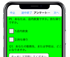
iPhoneのViewの座標が違う
iPhoneX未満の機種ではViewのY座標は64。
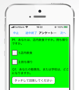
※緑がView
iPhoneX、11ではViewのY座標は88
64では頭が切れる
88で丁度よい
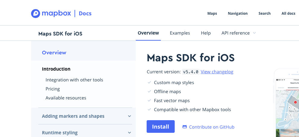
MapBox SDK を iOS Objective-C から使用
最初にmapboxのサイトでアカウントを作成しログイン
MapBox SDKのページを開く
https://docs.mapbox.com/ios/maps/overview/
インストールボタンをクリック
ダウンロードボタンをクリック
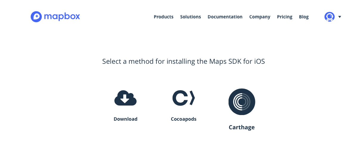
mapbox-ios-sdk-5.4.0-dynamic.zipをダウンロード
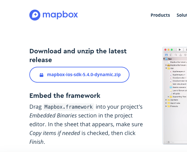
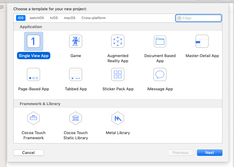
XCODEを起動してSingle View Appのプロジェクトを作成
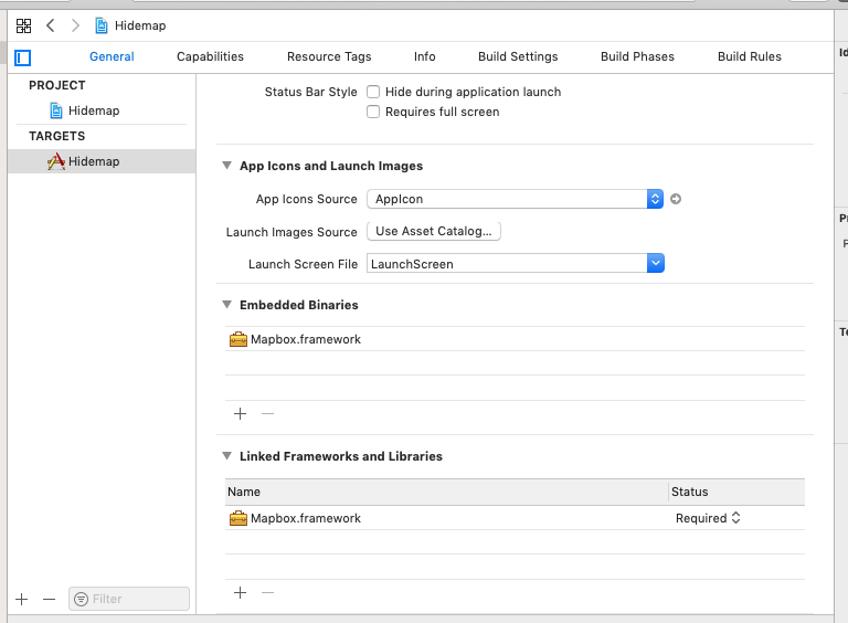
ダウンロードしたmapbox-ios-sdk-5.4.0-dynamic.zipを展開し中のMapbox.frameworkをEmbedded Binariesにドラッグして参照を追加
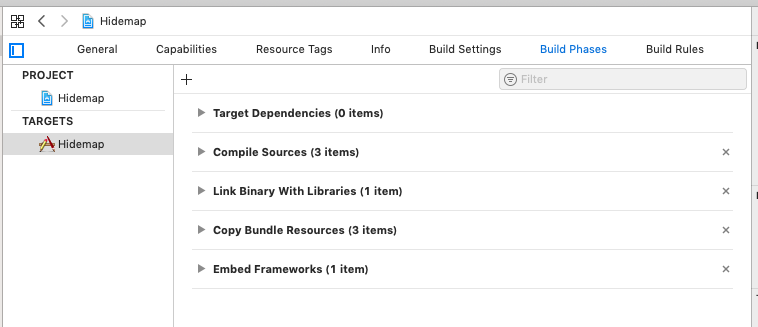
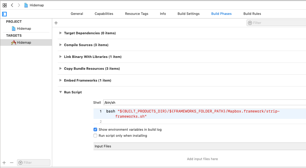
TARGETSのBuild Phases画面を開き、+(追加)ボタンを押す
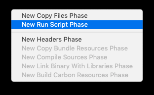
Run Scriptを追加しMapboxのサイトに従い設定
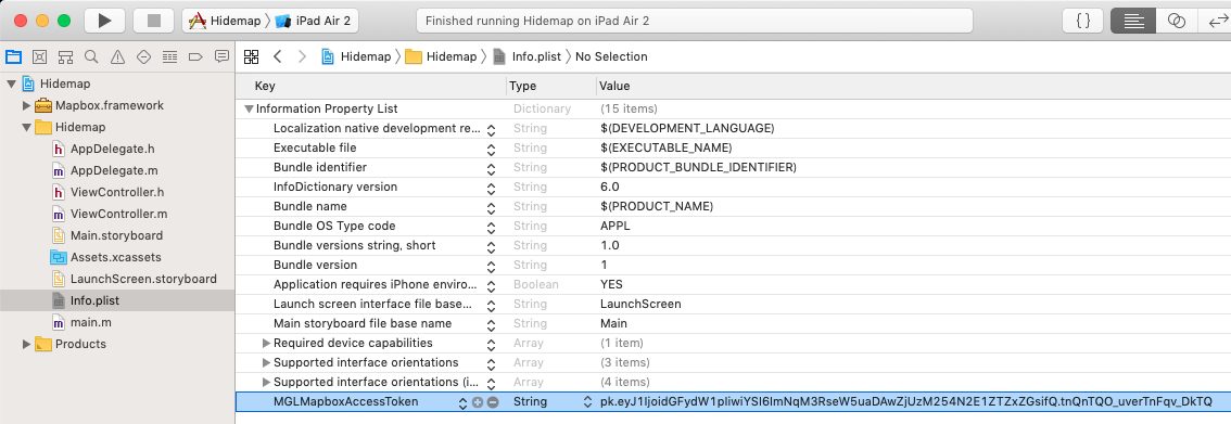
info.listにMGLMapboxAccessTokenを追加しキーを入力
ViewController.mを編集
[code]
#import "ViewController.h"
@import Mapbox;
@interface ViewController () <MGLMapViewDelegate>
@property (nonatomic) MGLMapView *mapView;
@end
[/code]
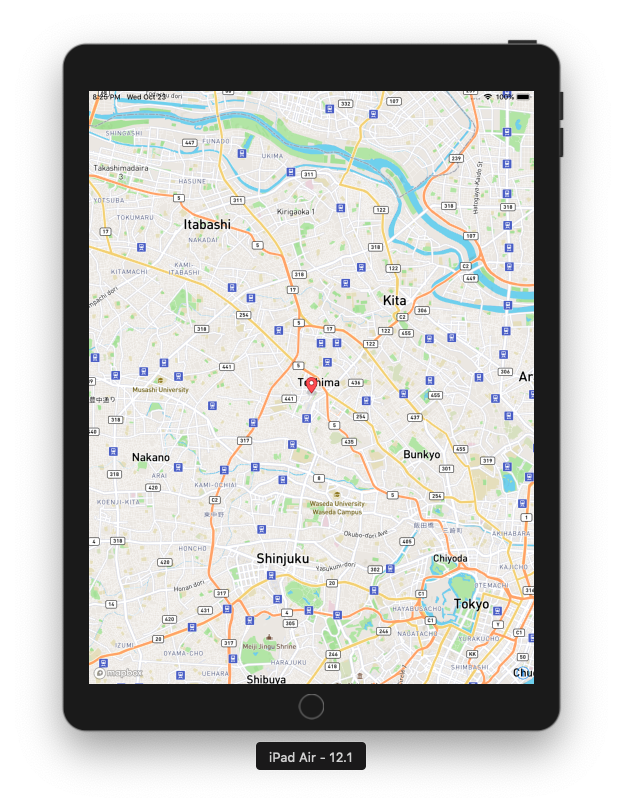
地図を表示
ViewControllerのviewDidLoadを以下に従って編集
[code]
– (void)viewDidLoad {
[super viewDidLoad];
NSURL *url = [NSURL URLWithString:@"mapbox://styles/mapbox/streets-v11"];
self.mapView = [[MGLMapView alloc] initWithFrame:self.view.bounds styleURL:url];
self.mapView.autoresizingMask = UIViewAutoresizingFlexibleWidth | UIViewAutoresizingFlexibleHeight;
[self.mapView setCenterCoordinate:CLLocationCoordinate2DMake(35.73353,139.712118)
zoomLevel:12
animated:NO];
self.mapView.delegate = self;
[self.view addSubview:self.mapView];
[[NSNotificationCenter defaultCenter] addObserver:self selector:@selector(offlinePackProgressDidChange:) name:MGLOfflinePackProgressChangedNotification object:nil];
[[NSNotificationCenter defaultCenter] addObserver:self selector:@selector(offlinePackDidReceiveError:) name:MGLOfflinePackErrorNotification object:nil];
[[NSNotificationCenter defaultCenter] addObserver:self selector:@selector(offlinePackDidReceiveMaximumAllowedMapboxTiles:) name:MGLOfflinePackMaximumMapboxTilesReachedNotification object:nil];
}
[/code]
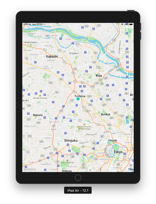
池袋を中心に地図を表示

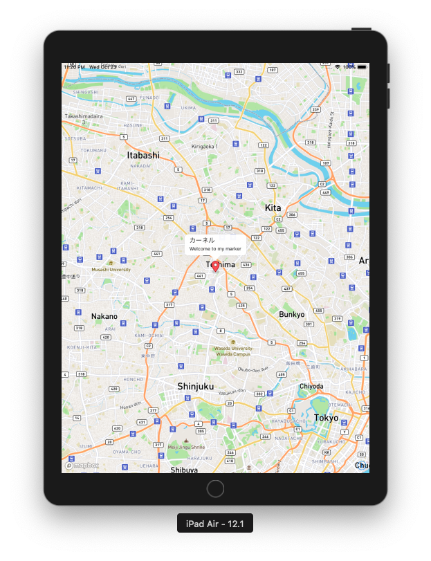
デフォルトのAnnotationを表示
[code]
– (void)mapViewDidFinishLoadingMap:(MGLMapView *)mapView {
MGLPointAnnotation *hello = [[MGLPointAnnotation alloc] init];
hello.coordinate = CLLocationCoordinate2DMake(35.73353,139.712118);
hello.title = @"カーネル";
hello.subtitle = @"Welcome to my marker";
[mapView addAnnotation:hello];
}
– (MGLAnnotationImage *)mapView:(MGLMapView *)mapView viewForAnnotation:(id <MGLAnnotation>)annotation {
return nil;
}
– (BOOL)mapView:(MGLMapView *)mapView annotationCanShowCallout:(id <MGLAnnotation>)annotation {
return NO;
}
[/code]
関数:annotationCanShowCalloutの戻り値にYESを返すとAnnotationをクリックするとTooltipを表示する
デフォルトのAnnotationではなくMGLAnnotationViewを使ってカスタムAnnotationを表示
viewForAnnotationでnilではなく、MGLAnnotationViewを返す
[code]
– (MGLAnnotationImage *)mapView:(MGLMapView *)mapView viewForAnnotation:(id <MGLAnnotation>)annotation {
// 100はannotationを区別するキー。テストなので固定
MGLAnnotationView *annotationView = [mapView dequeueReusableAnnotationViewWithIdentifier:@"100"];
if (!annotationView) {
annotationView = [[MGLAnnotationView alloc] initWithReuseIdentifier:@"100"];
annotationView.frame = CGRectMake(0, 0, 30, 30);
annotationView.layer.cornerRadius = annotationView.frame.size.width / 2;
annotationView.layer.borderColor = [UIColor whiteColor].CGColor;
annotationView.layer.borderWidth = 4.0;
annotationView.backgroundColor = [UIColor colorWithRed:0.03 green:0.80 blue:0.69 alpha:1.0];
}
return annotationView;
}
[/code]
MGLAnnotationViewを選択するとdidSelectAnnotationViewイベントが発生する
[code]
– (void)mapView:(MGLMapView *)mapView didSelectAnnotationView:(MGLAnnotationView *)annotationView {
NSLog(@"didSelectAnnotationView");
}
[/code]
Annotationに画像を表示
viewForAnnotationではnilを返すように戻し、imageForAnnotationでMGLAnnotationImageを返すように変更
[code]
– (MGLAnnotationImage *)mapView:(MGLMapView *)mapView viewForAnnotation:(id <MGLAnnotation>)annotation {
return nil;
}
– (MGLAnnotationImage *)mapView:(MGLMapView *)mapView imageForAnnotation:(id <MGLAnnotation>)annotation {
MGLAnnotationImage *annotationImage = [mapView dequeueReusableAnnotationImageWithIdentifier:@"100"];
if (!annotationImage) {
UIImage *image = [UIImage imageNamed:@"place8.png"];
image = [image imageWithAlignmentRectInsets:UIEdgeInsetsMake(0, 0, image.size.height/2, 0)];
annotationImage = [MGLAnnotationImage annotationImageWithImage:image reuseIdentifier:@"100"];
}
return annotationImage;
}
[/code]

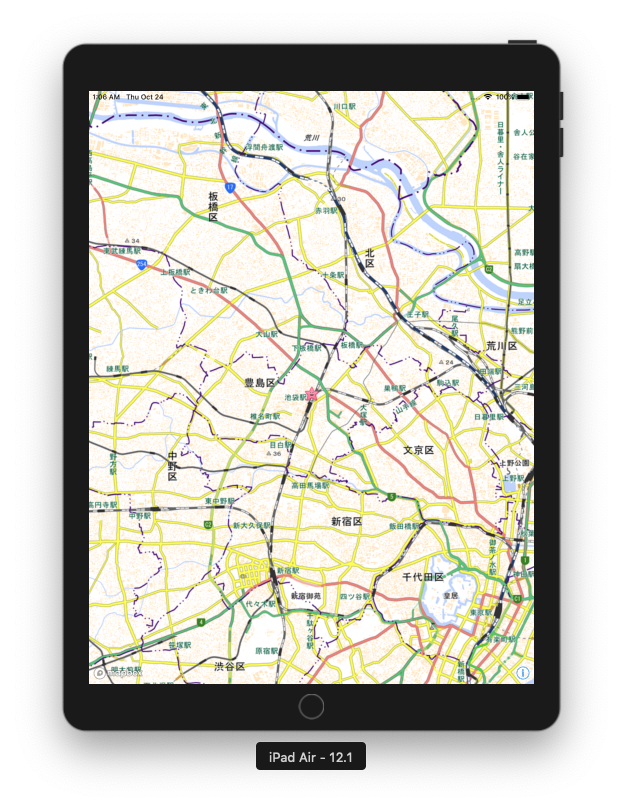
背景を国土地理院のタイル(ラスタ)に変更
baseman.jsonを作成(ファイル名は任意)
このファイルの内容はmapbox-gl-native for ios で地理院地図を表示してみるのそのまんまです
[code]
{
"version": 8,
"name": "Raster Tiles",
"sources": {
"gsiStd": {
"type": "raster",
"tiles": [
"http://cyberjapandata.gsi.go.jp/xyz/std/{z}/{x}/{y}.png"
],
"tileSize": 256
}
},
"layers": [{
"id": "gsiStd",
"type": "raster",
"source": "gsiStd",
"paint": {
"raster-fade-duration": 100
}
}]
}
[/code]
baseman.jsonをプロジェクトに追加
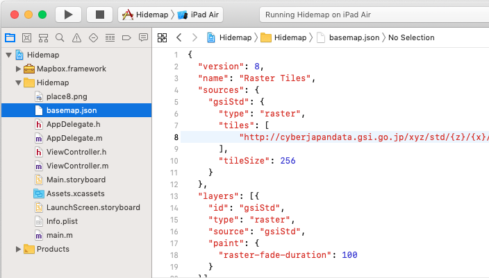
MGLMapViewのコンストラクタに渡すstyleURLを変更
[code]
– (void)viewDidLoad {
[super viewDidLoad];
NSURL *url = [[NSBundle mainBundle] URLForResource:@"basemap" withExtension:@"json"];
self.mapView = [[MGLMapView alloc] initWithFrame:self.view.bounds styleURL:url];
self.mapView.autoresizingMask = UIViewAutoresizingFlexibleWidth | UIViewAutoresizingFlexibleHeight;
[self.mapView setCenterCoordinate:CLLocationCoordinate2DMake(35.73353,139.712118)
zoomLevel:12
animated:NO];
self.mapView.delegate = self;
[self.view addSubview:self.mapView];
以下省略
}
[/code]
MapBox SDK 関連
Maps SDK for iOS
基本
タイルレイヤ(ラスタ)をオーバーレイで表示
ベクタータイルを表示
各種サンプル
オフラインマップ